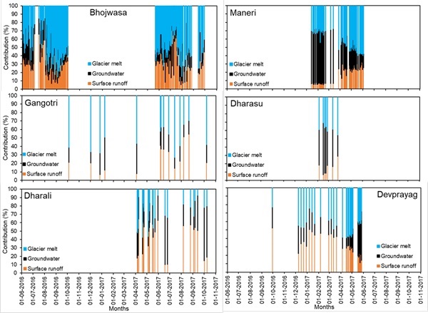
Upper Ganga Basin Maximum & Minimum Snow Map 2000-2018
Upper Ganga Basin Mid - Feburary & Mid - September Snow Map 2000-2018
Upper Ganga Basin Year Wise Snow Map 2000-2018
Upper Ganga Basin Month Wise Snow Map 2000-2018
Satluj Basin Maximum & Minimum Snow Map 2000-2018
Temporal Glaciated Areas in Beas and Upper Ganga Basins
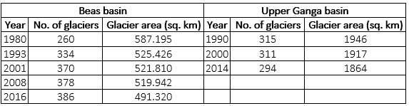
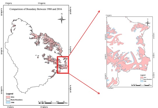
Glaciated Areas and Change in Areas in Beas Basin
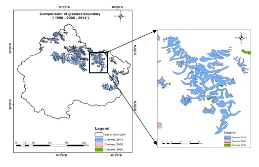
Glaciated Areas and Change in Areas in Upper Ganga Basin
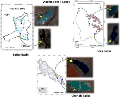
Identification of Vulnerable Glacial Lakes in Different Basins
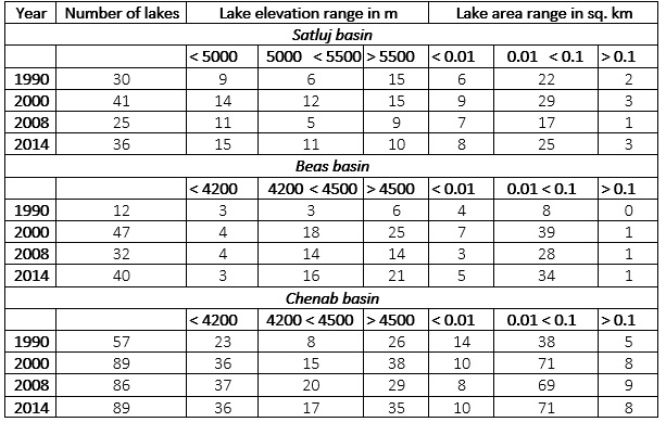
Lakes of Different Area and Above an Altitude in Different Basins
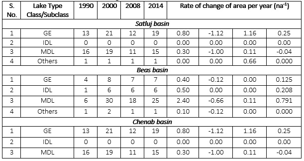
Glacier Lakes Changes in Different Basins from 1990 to 2014
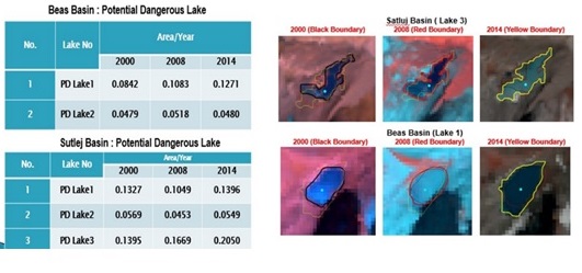
Potentially Dangerous Lakes in Different Basins
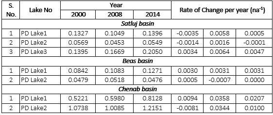
Areal Changes in Some Vulnerable Glacial Lakes in Different Basins