Inventory of extreme events is prepared by systematically scanning through the local and national
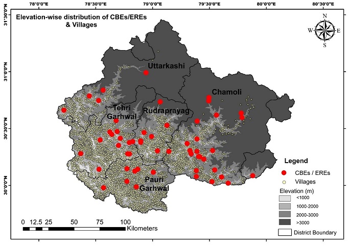
dailies and other online repositories since 2010. A total of 57 CBEs were recorded by this method,
with varying degrees of spatial accuracy.
Mapping of Cloudburst Events Over The UGB
Based on the recurrence of cloudburst events (CBEs) in the UGB, it is identified as a significant risk in the region. However, information on cloudburst flood occurrence is limited to periodic media reporting and mostly absent from the rainfall data from the region. Hence, the need was felt to build an inventory of CBEs of the area. Most often, CBEs impacts are highly localized at the village level. It is critical to collate information corresponding to these CBEs such as location, elevation, population under threat, etc. Climate and climate change of the mountainous regions are elevation-dependent, and the population dictates the risk due to extreme events under threat. It is noticed that the elevation wise population profiling does not exist in the region. As this information is critical for any climate change-related adaptive strategies, inventory of the villages and the corresponding population is mapped in the UGB as per the Census, 2011.
Study Area
Formulation of Questionnaire
Field Visits
Cloudburst Distribution and Vulnerability Assessment